AKL: The New Lay of the Land Nov 15, 02:37
In the coming days we'll post some pictures from our "winter training base" in Auckland -- a bit of a misnomer inasmuch as it is about to be summer there. In the meantime, for those of you not familiar with the changes since the end of the 2003 Cup, these satellite photos should help you get the new lay of the land. Images are courtesy of Google Earth with the somewhat crude graphics added by your Ed. As usual, you can click on the image to enlarge.
)
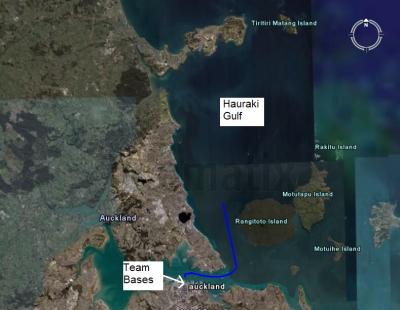
This is the big picture, showing the 40-minute tow (blue line) from the team bases in Viaduct Harbour out to the sailing area in the Hauraki Gulf.
)
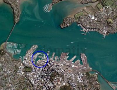
This is Auckland Harbour with the blue circle around Viaduct Harbour where the team bases are located. On the left is the Harbour Bridge, which runs from Westhaven (the RNZYS is at the SE foot of the Bridge) over to the "North Shore" (including Takapuna and Devonport).
)
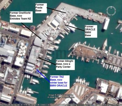
Viaduct Harbour used to be home to ten AC bases, of which four (sort of) remain. The area of the former south bases, from what was Team Dennis Conner to the old TNZ base (our new base), is now apartment buildings. The former northern-most base, the ex-Prada base, is now a parking lot for the fisherman. The former Oracle BMW Base, including the barge, is still intact; the sheds are used by boat building and repair companies, and the barge is owned by a special events company.
Auckland | by TFE